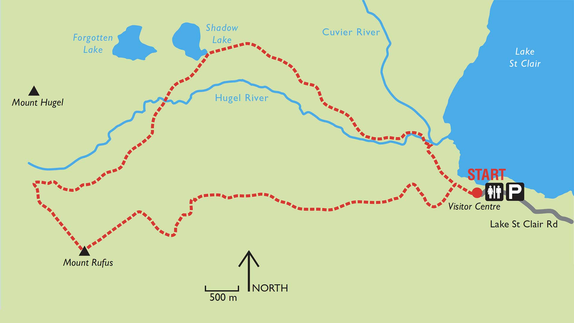
Mount Rufus, at 1416m, provides the experienced hiker with spectacular, panoramic views over the Western Wilderness area.
From the mountain’s many vantage points you will look out over Cradle Mountain Lake St Clair National Park, as well as the neighbouring parks. Mt Olympus, Frenchman’s Cap, the Franklin River headwaters and the beautiful Lake St Clair will all be revealed in a completely new light from your breathtaking, high perspective. Remember to take your camera.
The well defined walk from the Visitor Centre car park at Lake St Clair creates an 18km circuit that goes from 737m to 1416m. The walk is rated Level 3, suitable for hikers with a proficiency in bush walking and a good level of fitness. Note that tracks rated at Level 3 are often steep with a rough surface and may have areas with many steps.
As with all mountainous areas, track walkers should prepare themselves for both the terrain and the often extremely changeable weather. It is recommended that all walkers considering the Mt Rufus route carry all normal walking kit with the addition of thermal leggings or shorts (no cotton trousers or jeans). A warm hat or beanie and gloves should be included along with waterproof trousers, a good outer shell jacket, food and drink and most essential, a map of the area.
The 18km circuit takes an estimated 7hrs for walkers with a good level of fitness. This time is calculated for an easy, continuous walking pace and does not take into consideration time spent resting, eating or taking photographs etc.
Pets and firearms are prohibited in the national park and bicycles are not permitted on the tracks.
Park entry fees DO apply.
Facilities:
There is a Visitor Centre, restaurant and accommodation available at Lake St Clair at the beginning of the track.
Vehicle Access:
To reach the lake and the start of the Mt Rufus walk, turn off the Lyell Highway (A10) onto the C193 on the Queenstown side of the Derwent Bridge. It is approximately a 6km drive to the car park and facilities at the lake.

Leave A Comment