The Kelly Basin walk to the remnants of the town of East Pillinger is a walk into the rich and vibrant history of Tasmania.
A thousand people lived in East Pillinger its heyday. Today the town is no more, and its former existence is marked only by remnants half-hidden by lush mosses and tree ferns.
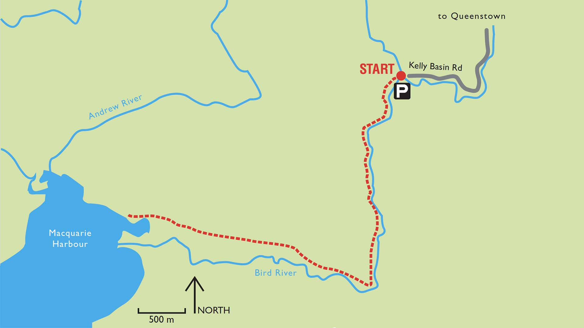
The Kelly Basin walk skirts the Bird River, following the route of what once was the railway line connecting East Pillinger with Queenstown and the outside world. The 5.4km (one way) walk is graded at Level 3, suitable for walkers with a proficiency in bush walking and a good level of fitness. Note that tracks rated at Level 3 are often steep with a rough surface and may have areas with many steps. This particular track has sections that are wet and muddy underfoot.
Walkers are advised to anticipate rapidly changing weather conditions. Make sure that you have good walking shoes or boots and in addition to standard hiking clothing ensure you have sun block, thermal leggings or shorts, and a warm hat or beanie. Gloves are recommended along with waterproof trousers and a good outer shell jacket. Please note that Jeans and cotton trousers should not be worn. Food and drink and a map of the area are essential.
With a total distance of almost 11kms for the return walk, you should allow approximately 4 hours. This time is calculated for an easy, continuous comfortable walking pace and does not take into consideration time spent resting, eating or taking photographs.
Pets, firearms and bicycles are prohibited.
Park entry fees DO NOT apply.
Facilities:
There are picnic tables near the beginning of the track and a toilet at Kelly Basin. Please note that at the picnic area and on the walking track only fuel stoves may be used.
Vehicle Access:
To reach the start of the Kelly Basin walk, leave Queenstown on the Mt Jukes Road and continue along it for approximately 30-minutes to the Bird River walking track. Note that for the last 20kms the road is shingle and the final 5kms are rated for 4×4 vehicles only.

Leave A Comment